Tahoe East Shore Trail: What to Know Before You Go
![]()
Even before the first line was drawn on a map in 1988, residents and visitors of North Lake Tahoe have been dreaming of a trail that provides a safer alternative for cyclists and beach goers near the scenic East Shore of Lake Tahoe. Through the work of 13 partners, the impossible is now a reality with the opening of the new Tahoe East Shore Trail. The opportunity now exists to safely explore a wide range of activities along the East Shore, whether walking, riding, or rolling. Here’s what you need to know before you go.
Access for All: The new Tahoe East Shore Trail offers a 3-mile long, 10-foot wide paved path that meets the American Disability Act standards to make certain that everyone can participate whether walking, rolling, running, or riding. Pedal-assist e-bikes are welcome, but leave motorized vehicles or scooters at home.
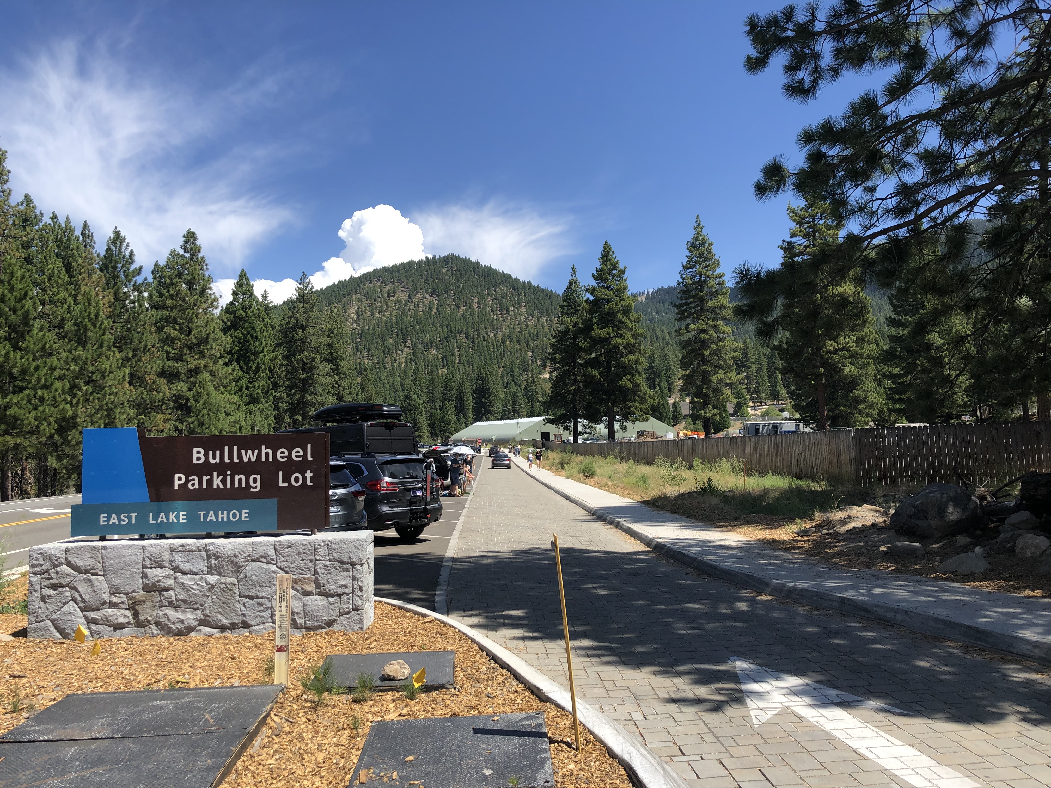
Parking: To alleviate the risk of crossing SR 28, there are 91 new parking spots at the northern end of the trail, ensuring a safer, easier place to unload for the day. Roadside parking along SR 28 is now prohibited. You must pay to park in peak seasons. You can text tun1-1 to 727563 to pay by phone.
Shuttle Services: The East Shore Express is a great way to access the path if parking is full. Pick up the shuttle at the old Incline Elementary School on Southwood or the Sand Harbor Visitors Center. Bus fare is $3 for the general public, and $1.50 for seniors and individuals with disabilities.
Bike Rentals: Rent a bike to explore the new trail at Flume Trail Bikes (https://flumetrailtahoe.com/) located at the Northern Trailhead, or at Village Ski Loft located about one mile north on SR 28.
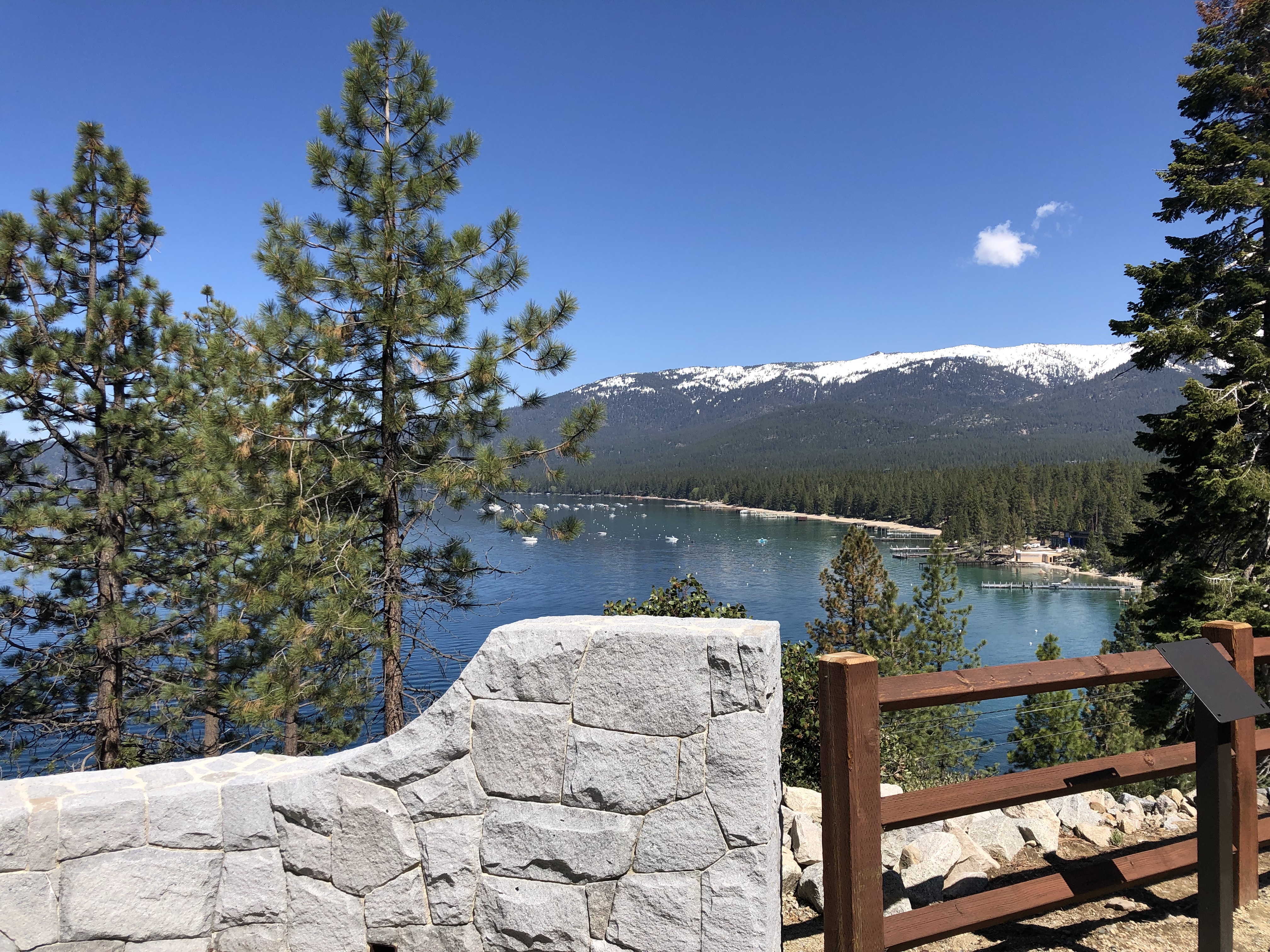
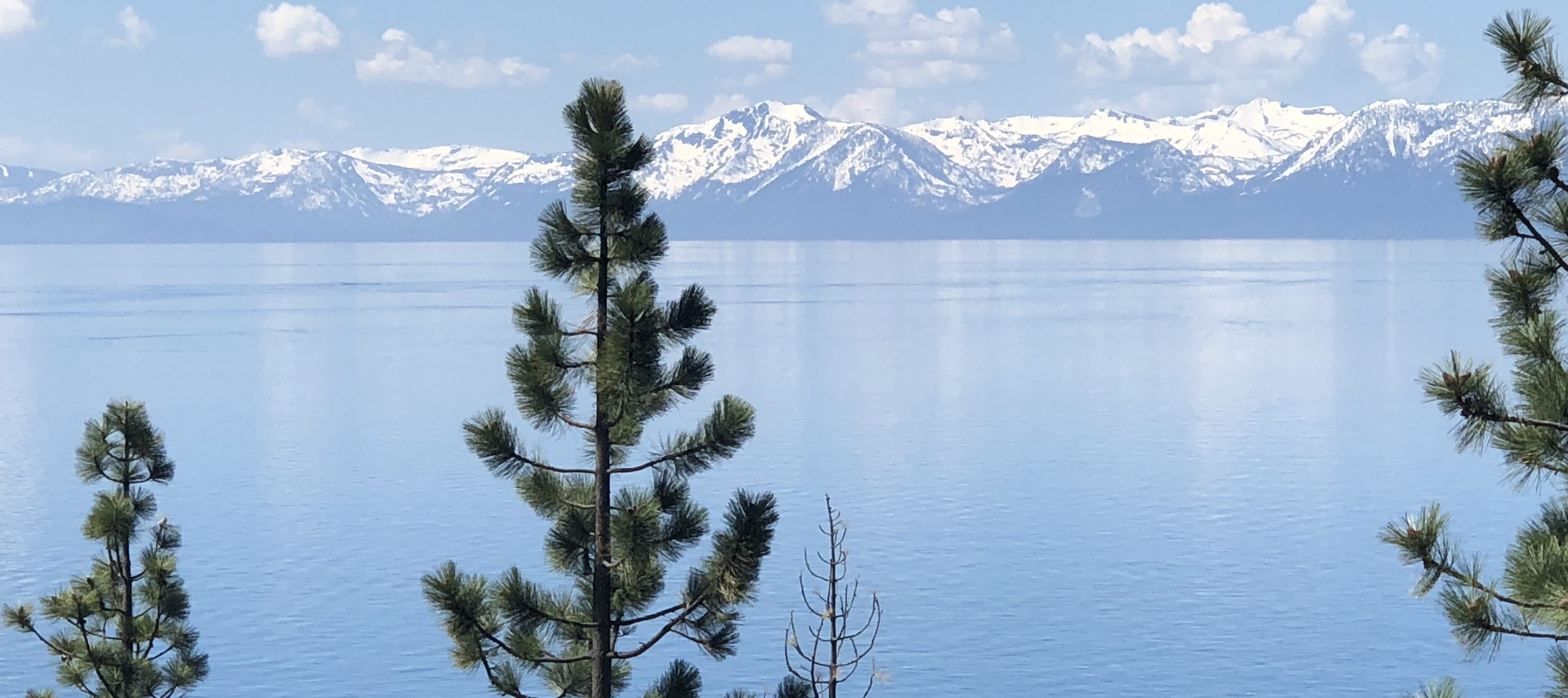
Mountain Side to the Lake: The first mile of the path is on the mountain side of the highway, offering spectacular views of Tahoe from a completely new vantage point. Cross through the tunnel, and enjoy two miles of path along the shoreline. The steepest section of the path is on the mountain side, but it never reaches more than 8% grade.
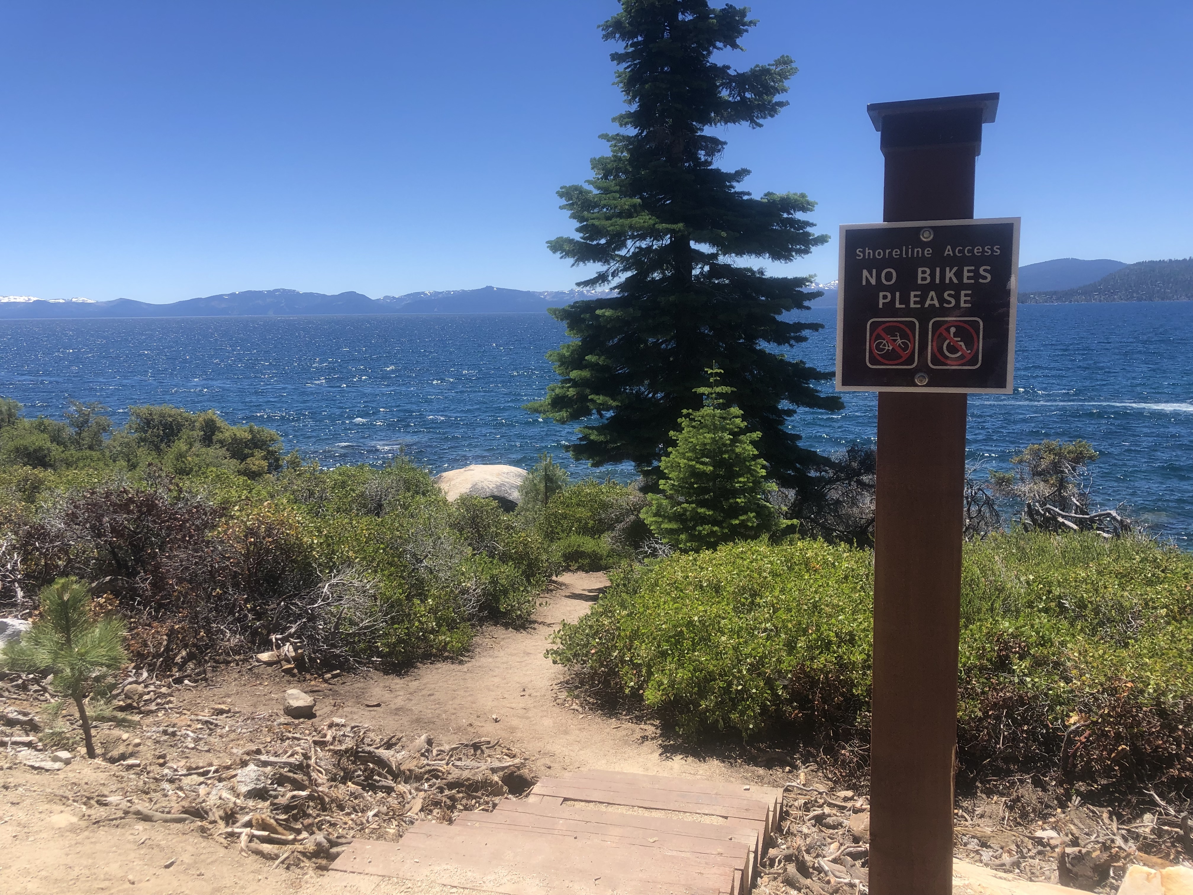
Beach Access Points: Bring a towel! The East Shore Trail offers 11 beach access points for a cool, refreshing mid-trail swim, including safer and easier access to the popular Hidden Beach. Bike racks along the path offer a secure place to lock up a bike or stroller.
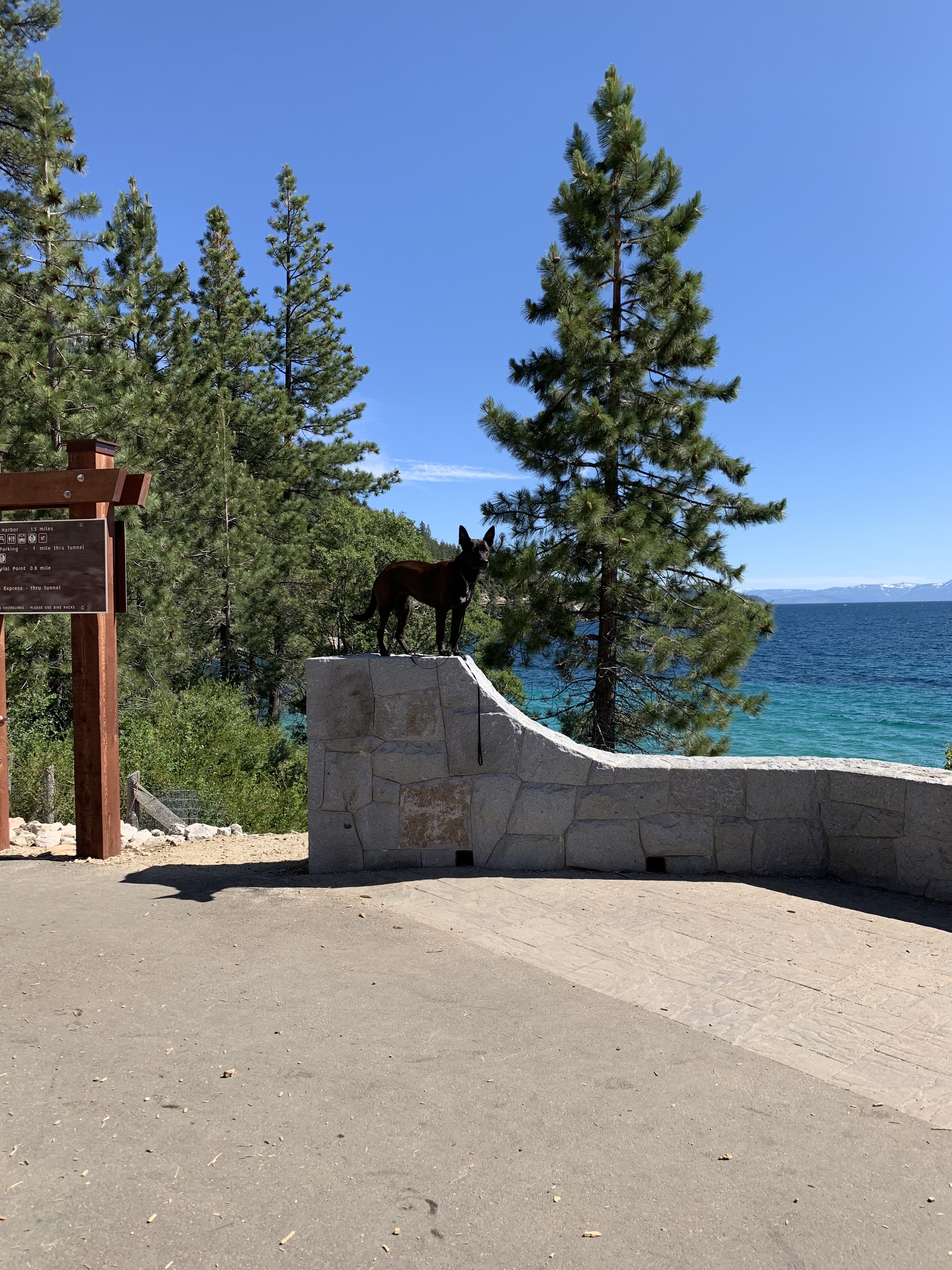
Dogs: The trail is pet friendly, so leashed four-legged family members are welcome. Keep in mind the path does get very hot during peak sunlight hours as there is very little shade, especially on the long bridge. Dogs are not recommended during hot summer days. And, don’t forget to pick up after your pup.
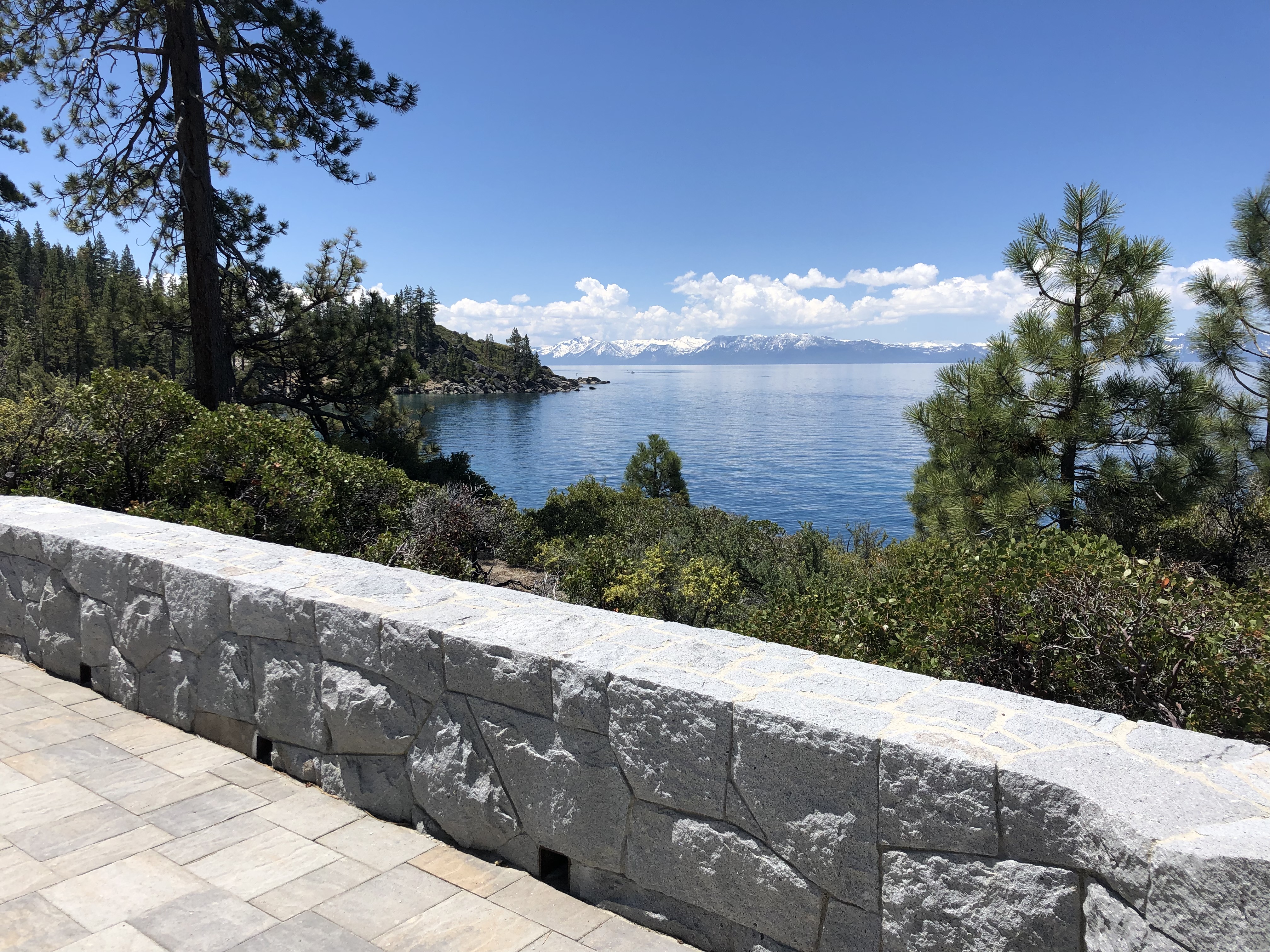 Vista Points: There are 16 vista points along the path that offer beautiful rest stops to get off the path and enjoy the views. While there, take the time to read the inscriptions vista point donors wrote on their Tahoe-shaped plaques.
Trail Etiquette: As you can imagine, the path is very popular for walkers and cyclists. Please stay to the right and pass on the left. Don’t walk four or more across the path. Cyclists must yield to hikers.
Tunnel Creek Café: Located at the Northern Trailhead, a new remodel of this popular trailhead cafe (re-opening soon) will be sure to take care of all your pre- and post-trail needs. From the Café, you can access a lot of really exciting mountain bike rides and hikes including the iconic Flume Trail and Monkey Rock.
Bears and Trout: Along the path you will notice bears set in concrete and steel trout mounted along the bridges. These are in honor of Tahoe Fund donors who help raise more than $1M in private donations to secure the public funding needed for the path. 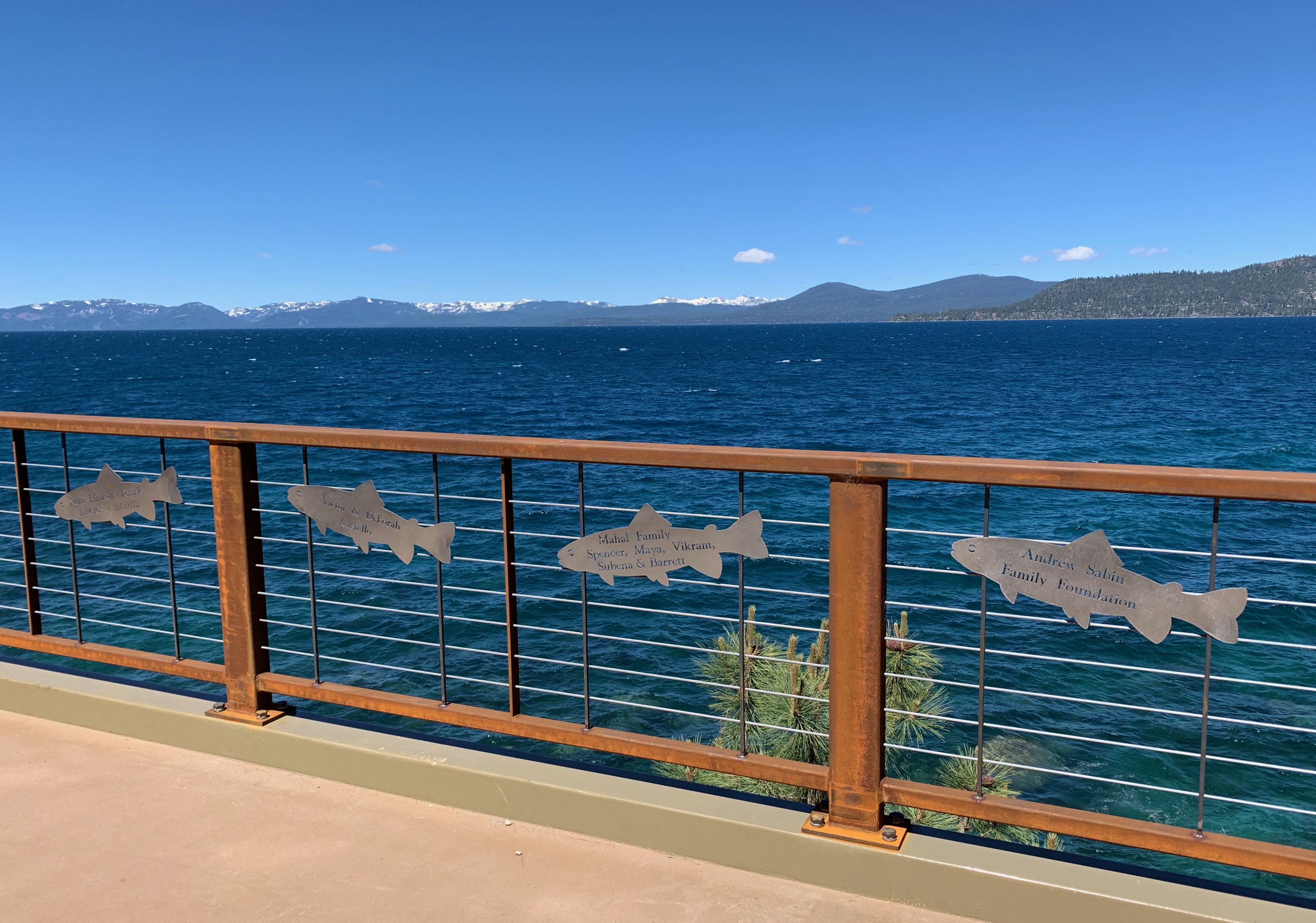 All donations of $100 or more are featured on the donor wall at the start of the trail. Donations are still being accepted. If you would like your name added to the path on a bear, trout or the next donor wall, visit tahoefund.org/donate.
Sand Harbor: The Southern most end of the trail concludes at Sand Harbor, a wonderful place to enjoy Lake Tahoe and spend time with friends and family. Entrance from the path is $2 for both cyclists and pedestrians. The most popular State Park in Nevada, Sand Harbor offers access to giant boulders, crystal clear water, sandy beaches, and kayak rentals among other things.
Pack In, Pack Out: Do your part to take care of Tahoe by always picking up your trash and personal belongings before you go.
Now that you know what to expect, get out on the path and see for yourself how the “Impossible Trail” became reality.