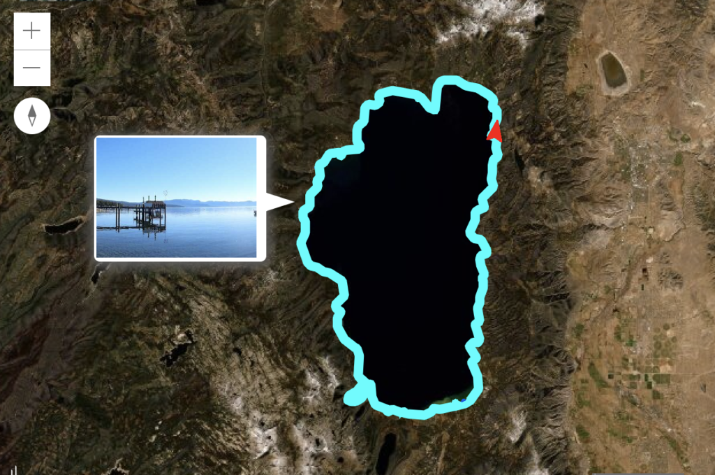
Lake Tahoe ShoreView Map
Partners: EarthViews Conservation Society
Funded Grants: $8,000
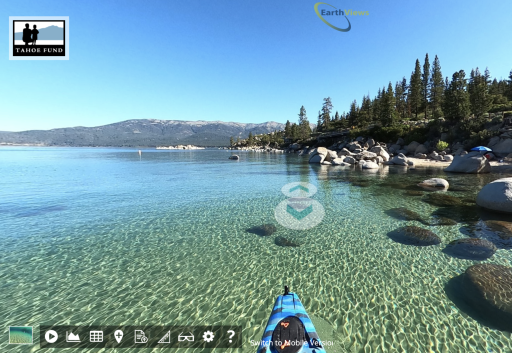
What if you could tour Emerald Bay, ‘paddle’ through the iconic rocks of Sand Harbor, or explore the hidden beaches along the East Shore, with just the click of a button?
The Tahoe Fund and EarthViews Conservation Society released the first-ever “Street View” style map of all 72 miles of Lake Tahoe’s shoreline. This new, interactive Lake Tahoe ShoreView Map offers a 360-degree view of the shoreline, as well as underwater views and water quality data. Best of all, this new tool is bringing a wealth of data and information to scientists and conservation organizations working to improve the health of the Lake.
To create this map, EarthViews Conservation Society President and Co-Founder Brian Footen spent seven days circumnavigating the Lake in a kayak, with cameras and water quality measurement tools strapped to the vessel. Using mobile mapping technology, Footen was able to capture synchronized imagery and data every ten seconds as he navigated along the nearshore. This information was then published online as a “street view” like experience letting the user explore the shoreline from their desktop or mobile device.
Learn more about the project and check out the live map.